

Wayfinding Plan / Signage Design / Map Design
Gateway Green is a new off-road bicycle park in Portland, Oregon. Sandwiched between two freeways, it’s a great example of resourceful land use as well as community advocacy leading to real impact.
Portland Parks and Recreation and project architect Greenworks invited us to design the park’s wayfinding.

We designed a wayfinding plan, park signage and trail map.


The graphic system uses bold colors, symbols and pictograms to communicate consistently and confidently throughout the Park.
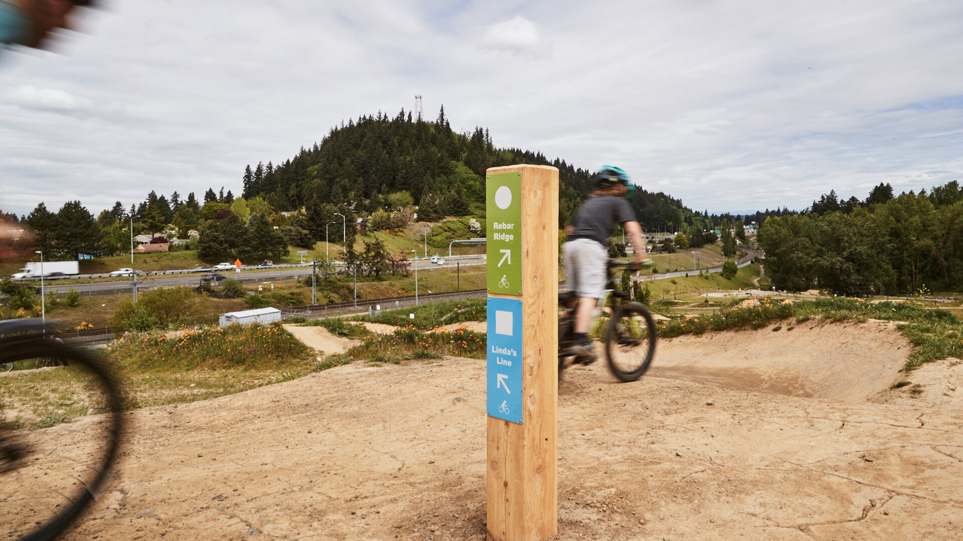

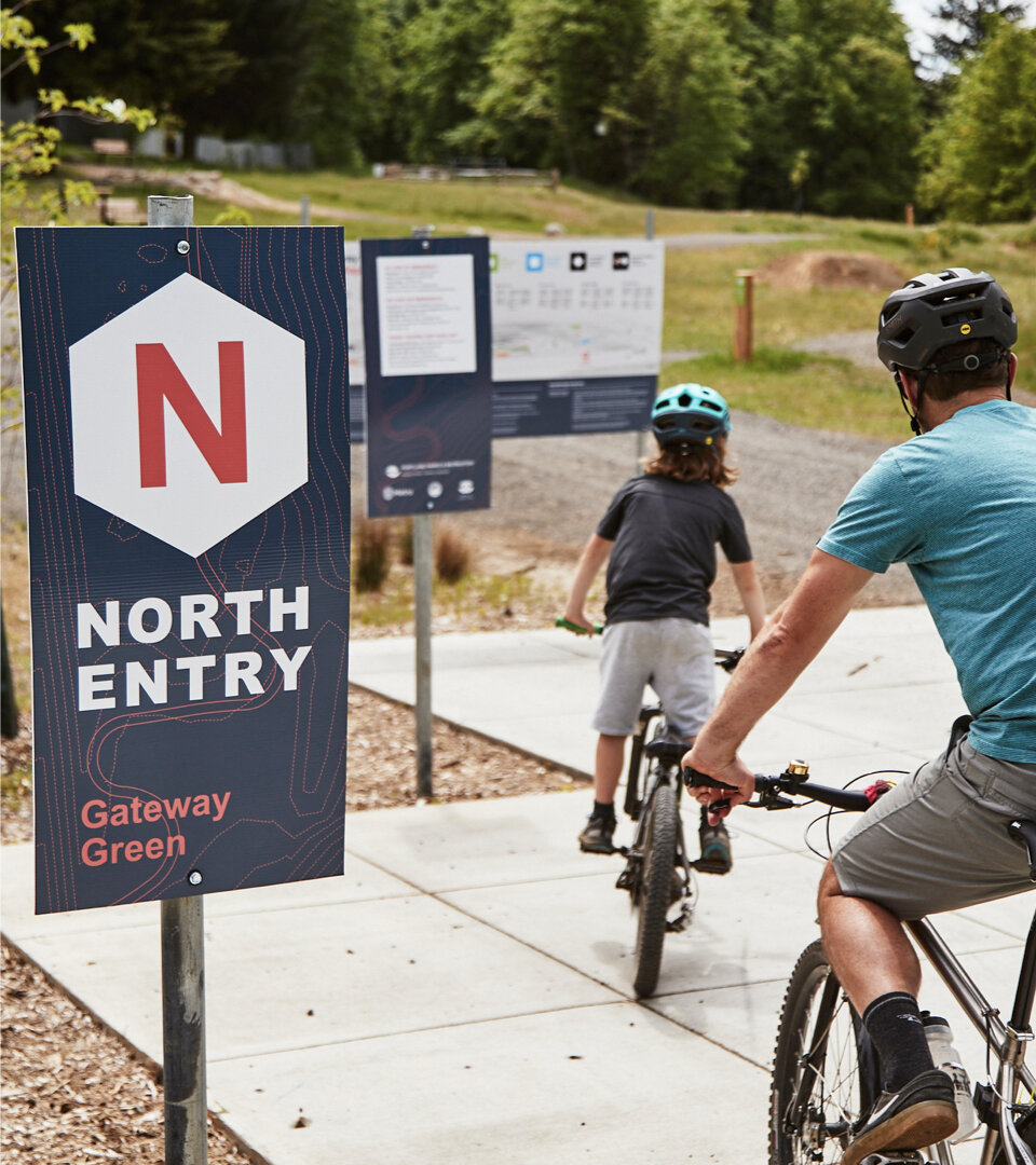
The sign graphics are deliberately minimal—conveying the most critical information only—so that riders can quickly read them without stopping on the narrow, singletrack (one-way) trails.
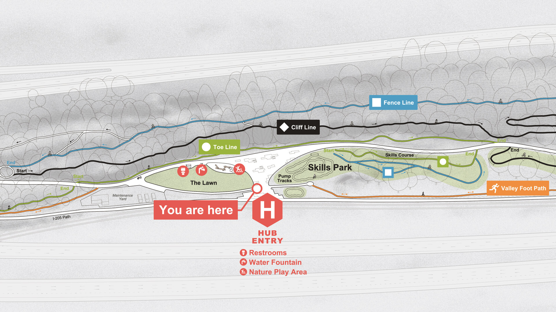
Colors and symbols work in concert with the trail map to consistently communicate routes to riders.
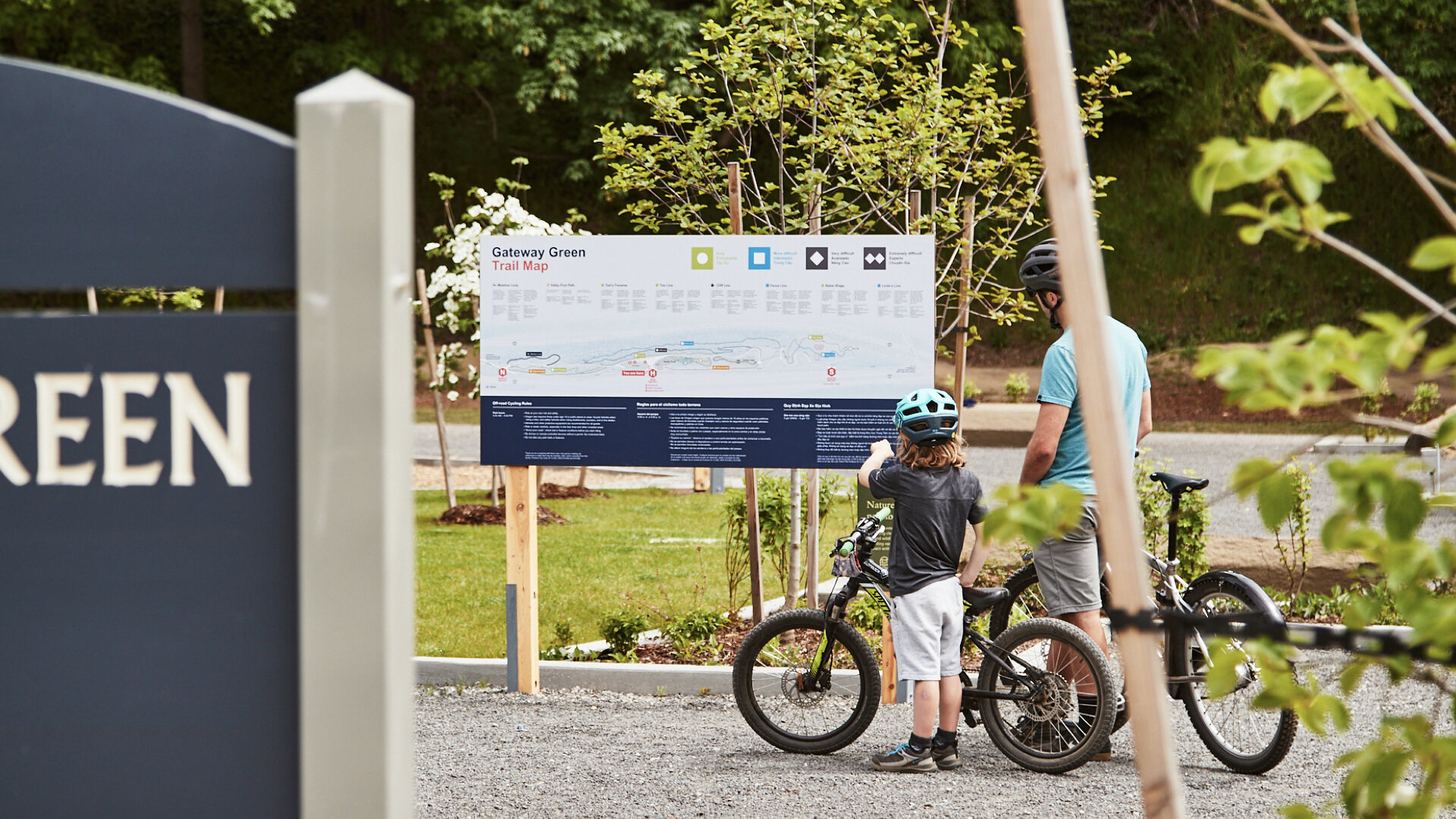


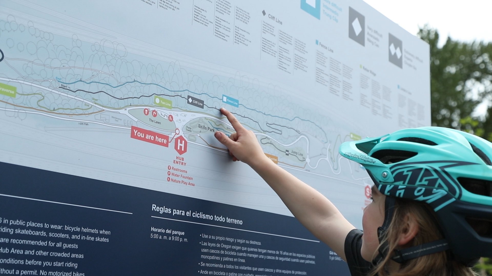
The 3D map design integrates illustrations of trees, bicycle riders and landmarks to quickly orient visitors and to encourage people new to riding to give it a try.
It’s easy to read for people young and old. Pictured here, a child shares the route he rode (a black diamond!) during his visit to the Park.
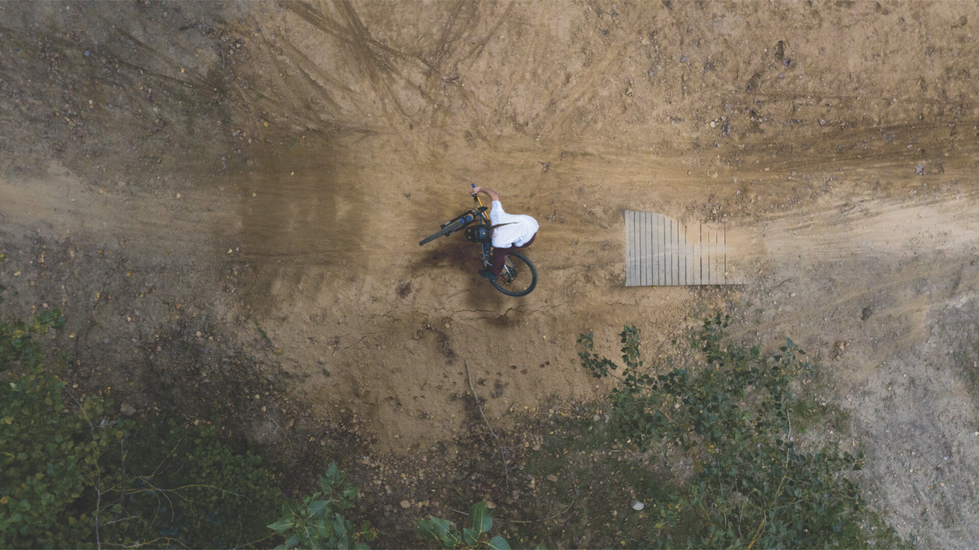
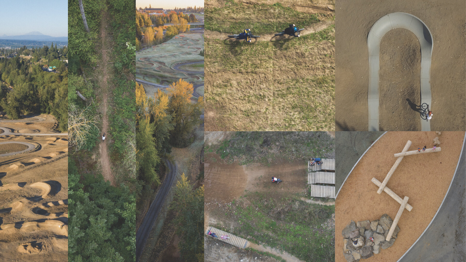
During the project, we learned that photographer James Mustico had been documenting the Park’s construction. We worked together to integrate his captivating aerial photography into the park signage.


The signs include Vietnamese, Spanish and English, common first-languages in communities near the park.
Temporary signs currently mark all three park entries and will (fingers crossed) be replaced by larger signs that are visible from a distance and help orient visitors. We used the park’s unique topography to create a pattern for them and aerial photos to aid orientation.
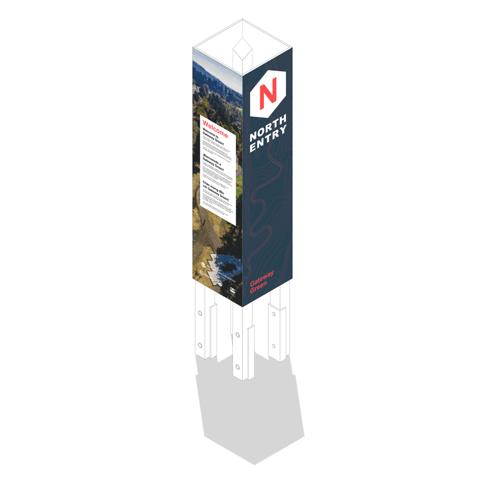

Instead of cedar or pressure-treated wood, the sign posts are made of Juniper, a sustainable way to use an invasive, but durable, species in the West.

Finally, we coordinated the new signs with Portland Parks and Recreation’s existing sign standards—and had the opportunity to have some fun with a few of them.